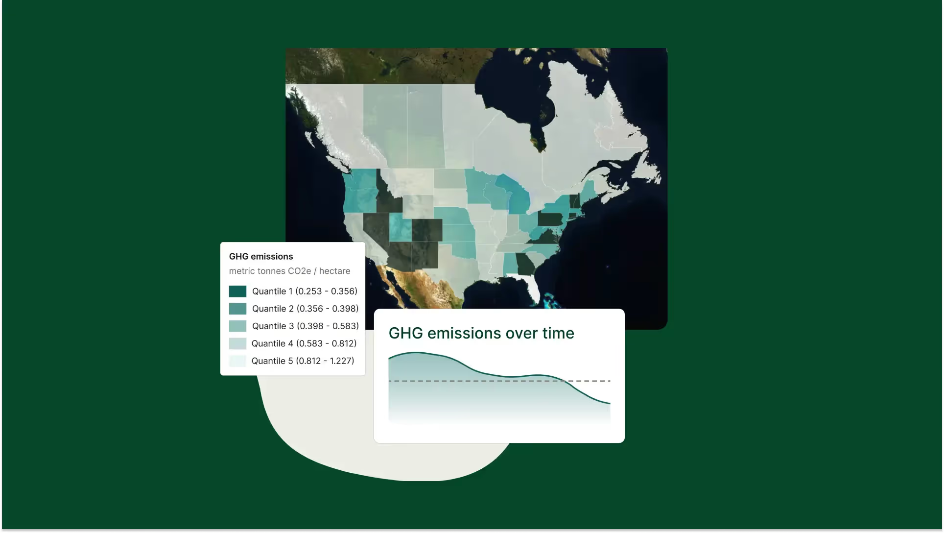
Conduct rigorous scope 3 analysis, create actionable carbon reduction plans, and track environmental outcomes on the farm
Deliver progress against your sustainability commitments with Regrow’s flexible MRV, which captures the impact of a broad range of sustainability outcomes.
Regrow's MonitorML, a new remote sensing-based machine learning model, unlocks reporting and project planning for regenerative agriculture
Discover Spatial Exploration, Regrow's interactive geospatial heatmap. Track practice adoption and environmental outcomes to optimize regenerative ag planning.
In addition to running tree analysis on individual fields, now you can select multiple fields to run the trees analysis on.
Each remote sensing platform has different spatial and temporal resolutions, sensors and costs. Learn which will be best for your farming operation.
Regrow CEO Anastasia Volkova talks about remote sensing and agriculture on the “Investing in Regenerative Agriculture” podcast.
Explore various vegetation indices like NDVI, MSAVI, NDRE, CCCI, and TCI. This guide clarifies what they measure and when to use each throughout the crop cycle.
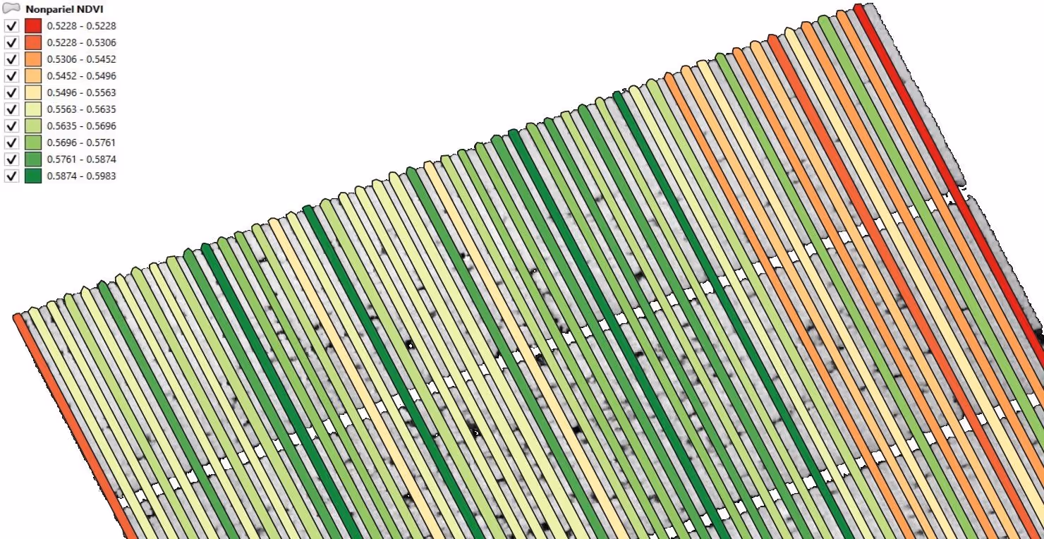
The orchard has 4 varieties, each with specific irrigation needs. Valves A and B cater to these, with A watering Nonpareil and B the remaining 3 varieties.
Use the zoning tool to divide fields by crop performance. Create site-specific management plans with tissue sampling points for in-field application.
.avif)
.avif)